D-Day. The Story of D-Day Through Maps.
ISBN: 9780007592838
Printed: 2014
Publisher: Harper Collins. London
| Dimensions | 23 × 27 × 2 cm |
|---|---|
| Language |
Language: English
Size (cminches): 23 x 27 x 2
Condition: Fine (See explanation of ratings)
£18.00
Buy Now


Item information
Description
Black board binding with red title and picture of soldiers leaving a landing craft.
-
F.B.A. provides an in-depth photographic presentation of this item to stimulate your feeling and touch. More traditional book descriptions are immediately available.
-
Note: This book carries the £5.00 discount to those that subscribe to the F.B.A. mailing list.
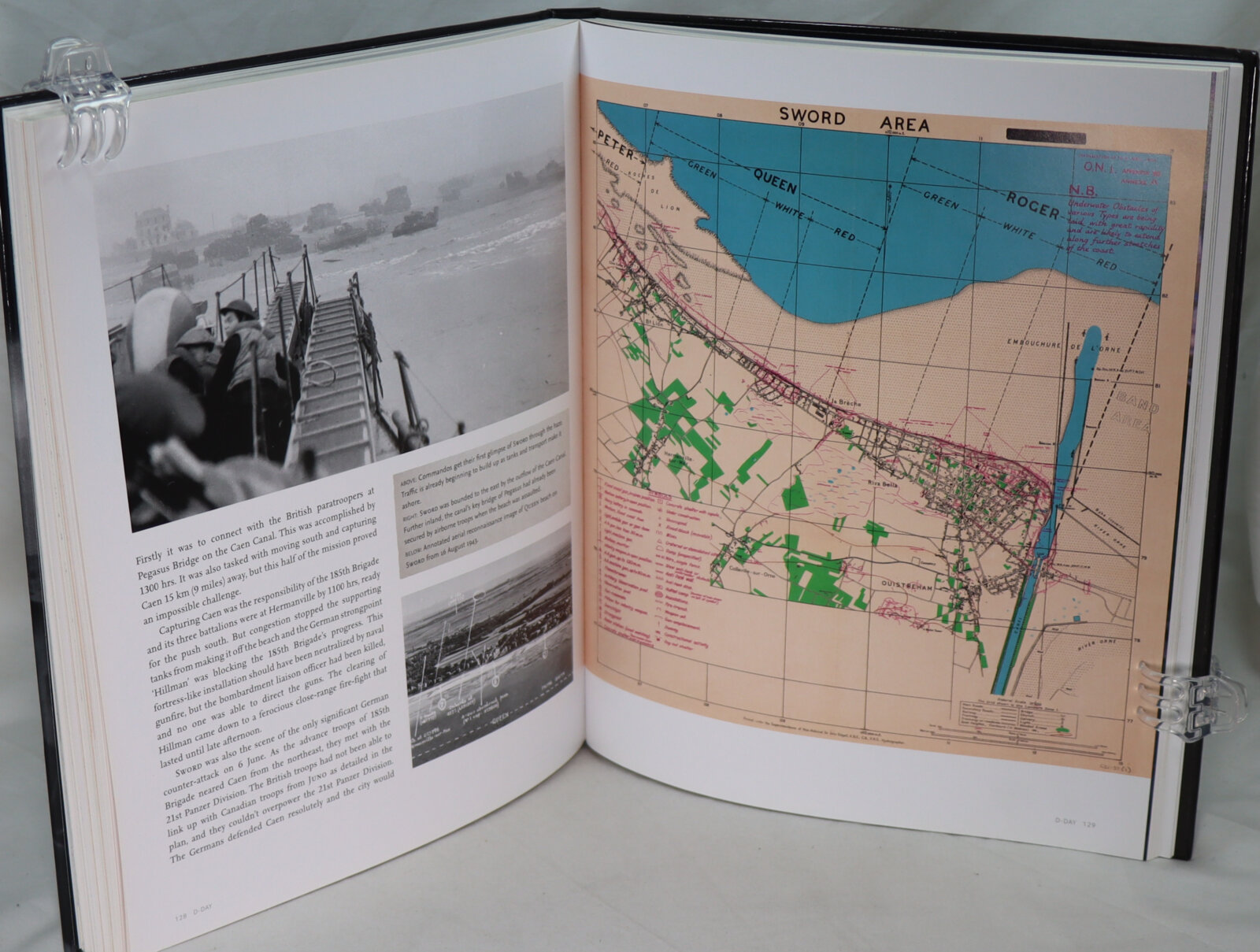
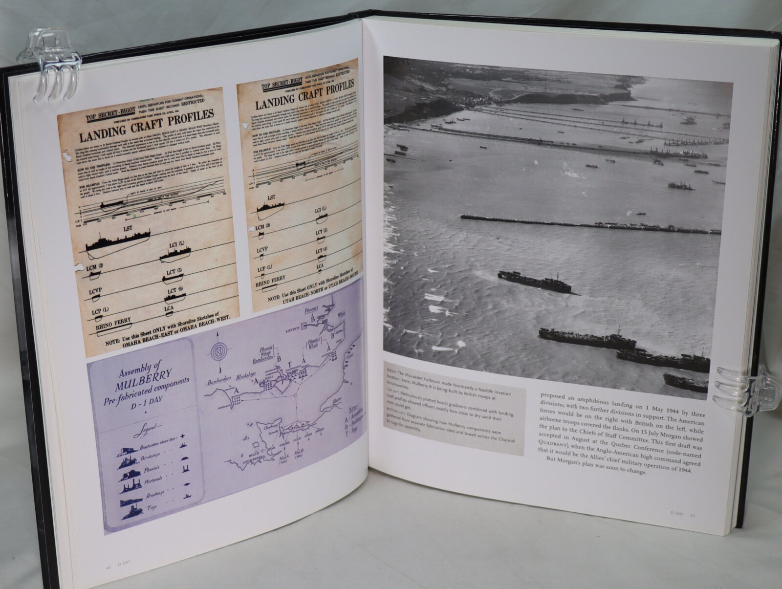
Following the D Day landings, the most incredible mapping effort the world has ever seen.
Key maps include:
-
Top-secret maps of Normandy with overprints showing the
beach defences. -
Plans of the Allied deception schemes.
-
Detailed maps of all five landing beaches, including OMAHA
and UTAH. -
Chart of the armada’s route across the English Channel.
-
Maps showing the Allied Forces’ movements as they pushed across France towards Berlin and VE Day.
This collection of incredible maps uncover the events that led up to D-Day, the planning for the assault and the progress of the liberating forces afterwards.
Want to know more about this item?
We are happy to answer any questions you may have about this item. In addition, it is also possible to request more photographs if there is something specific you want illustrated.
Ask a question
Related products


Share this Page with a friend