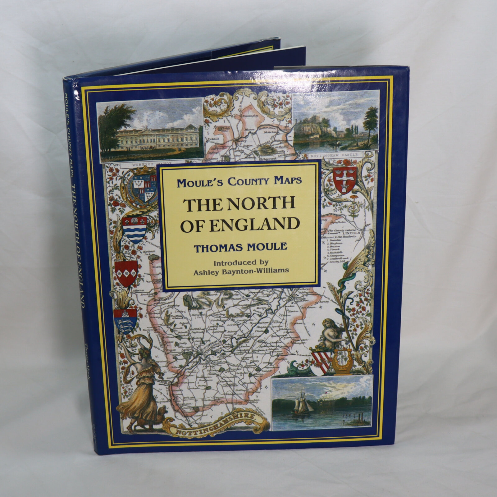
The North of England. Moule's County Maps.
ISBN: 9781858911946
Printed: 1994
Publisher: Bracken Books. London
| Dimensions | 24 × 30 × 2 cm |
|---|---|
| Language |
Language: English
Size (cminches): 24 x 30 x 2
Condition: Fine (See explanation of ratings)
£23.00
Buy Now
Your items

Item information
Description
In the original dustsheet. Navy cloth binding with gilt title on the spine.
-
F.B.A. provides an in-depth photographic presentation of this item to stimulate your feeling and touch. More traditional book descriptions are immediately available.
Hardcover. Condition: As New. A previously owned copy that is unblemished and appears unread.

Moule’s map of the hundreds of Monmouthshire, c. 1831
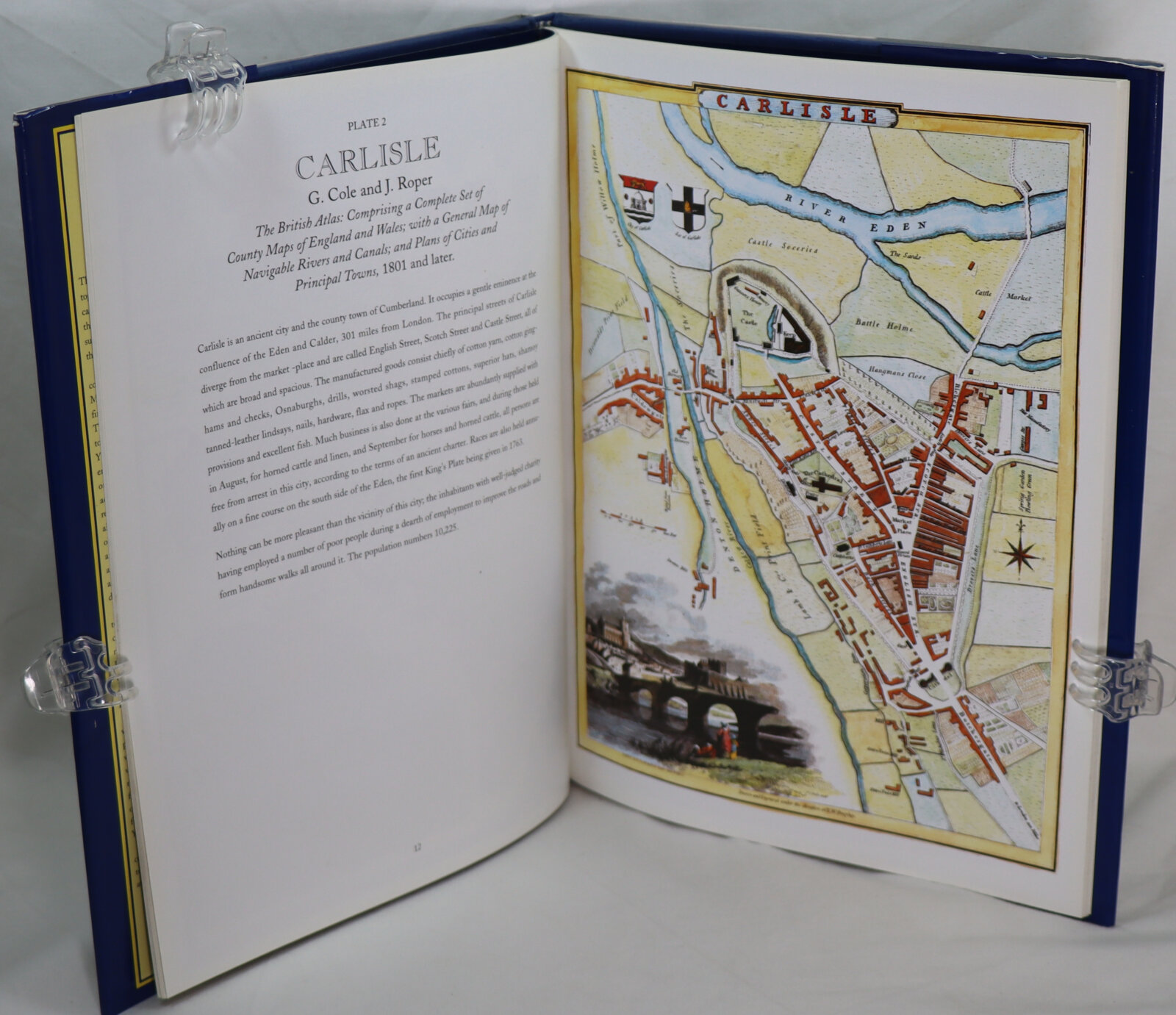
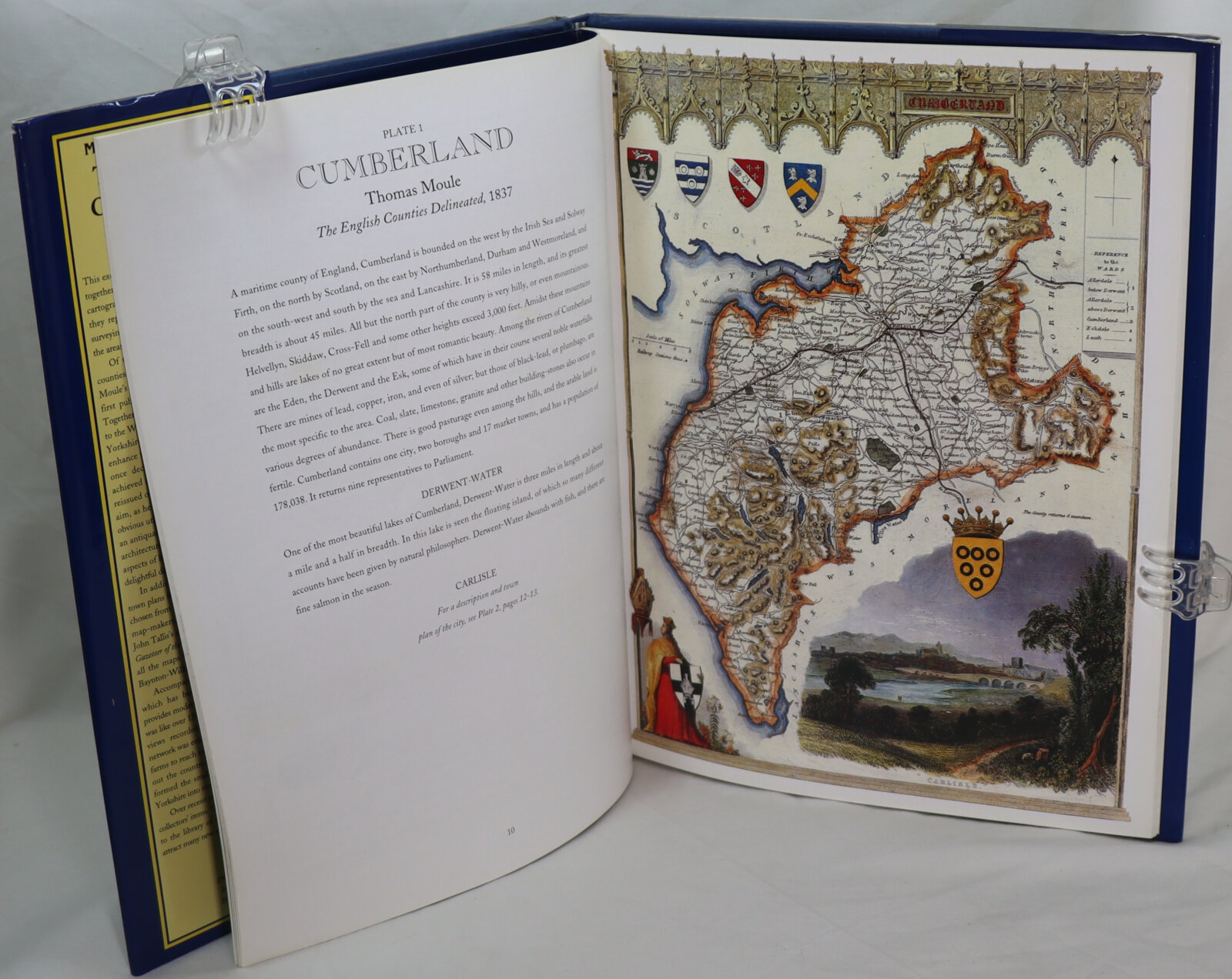
Thomas Moule (14 January 1784 – January 1851) was an English antiquarian, writer on heraldry, and one of Victorian England’s most influential map-makers. He is best known for his popular and highly decorated county maps of England, steel-engraved and first published separately between 1830 and 1832.
Moule was born in Marylebone, London. He sold books in Duke Street, Grosvenor Square, from 1816 to 1822. Later, he became an inspector of ‘blind’ (illegibly addressed) letters at the General Post Office. He died at his residence in St. James’s Palace, to which he was entitled as Chamber-keeper in the Lord Chamberlain’s Department.
Want to know more about this item?
We are happy to answer any questions you may have about this item. In addition, it is also possible to request more photographs if there is something specific you want illustrated.
Ask a question


Share this Page with a friend