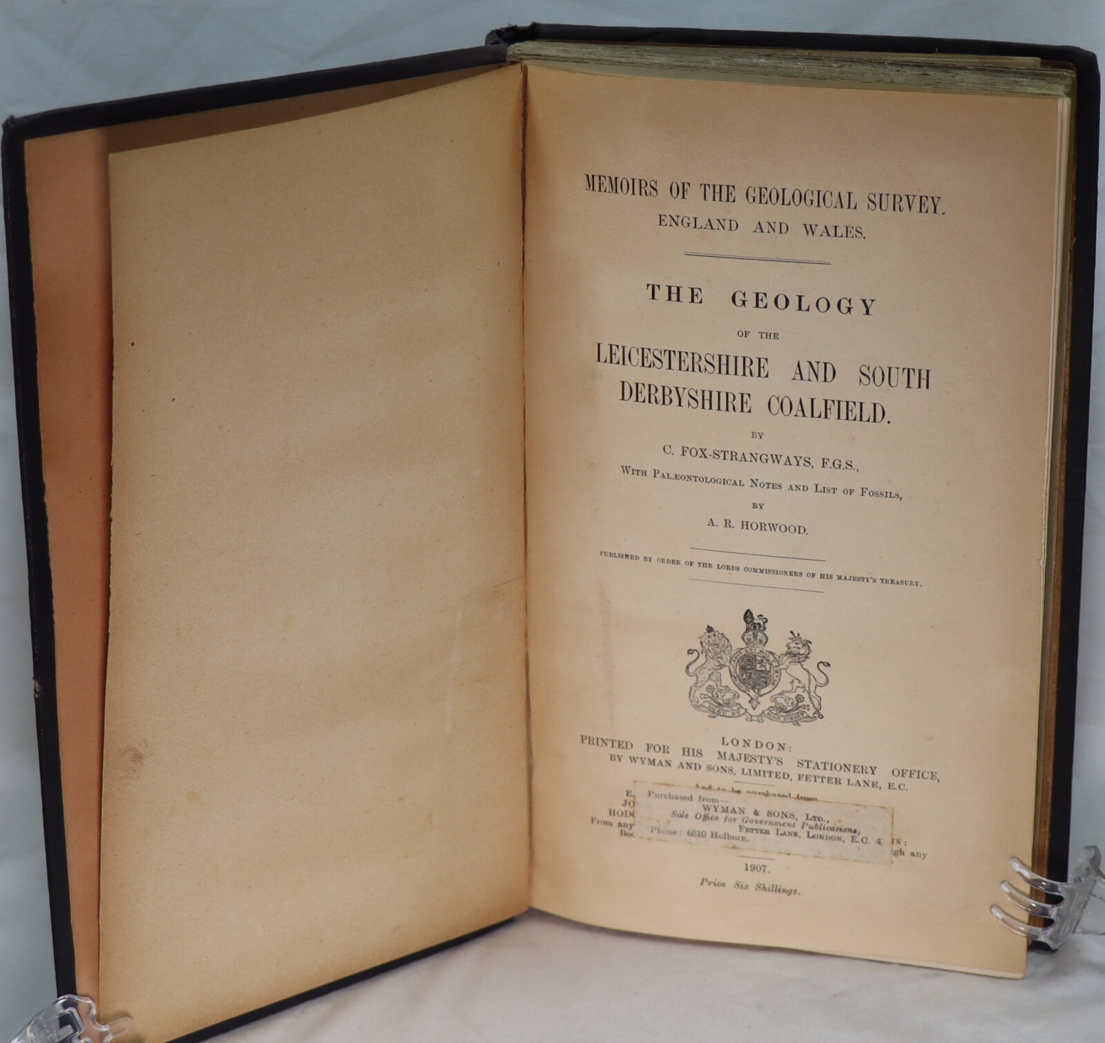
The Geology of Leicestershire and South Derbyshire Coalfield.
By C Fox-Strangeways
Printed: 1907
Publisher: His Majesty's Stationery Office. London
| Dimensions | 17 × 26 × 3 cm |
|---|---|
| Language |
Language: English
Size (cminches): 17 x 26 x 3
Condition: Very good (See explanation of ratings)
£99.00
Buy Now

Item information
Description
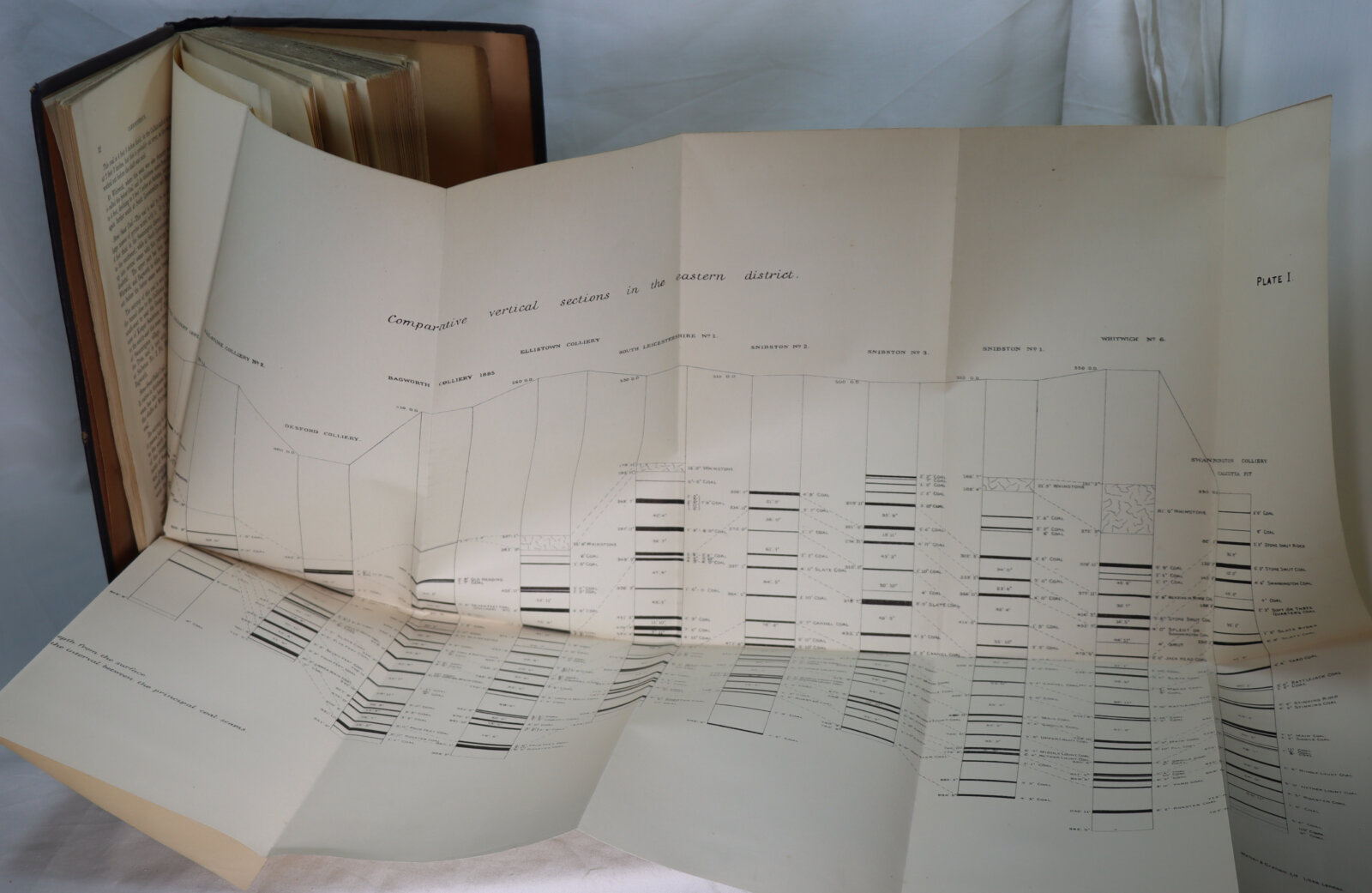
Green cloth binding with gilt title on the spine and gilt Geology Survey emblem the front board. Several fold out maps.
-
F.B.A. provides an in-depth photographic presentation of this item to stimulate your feeling and touch. More traditional book descriptions are immediately available.
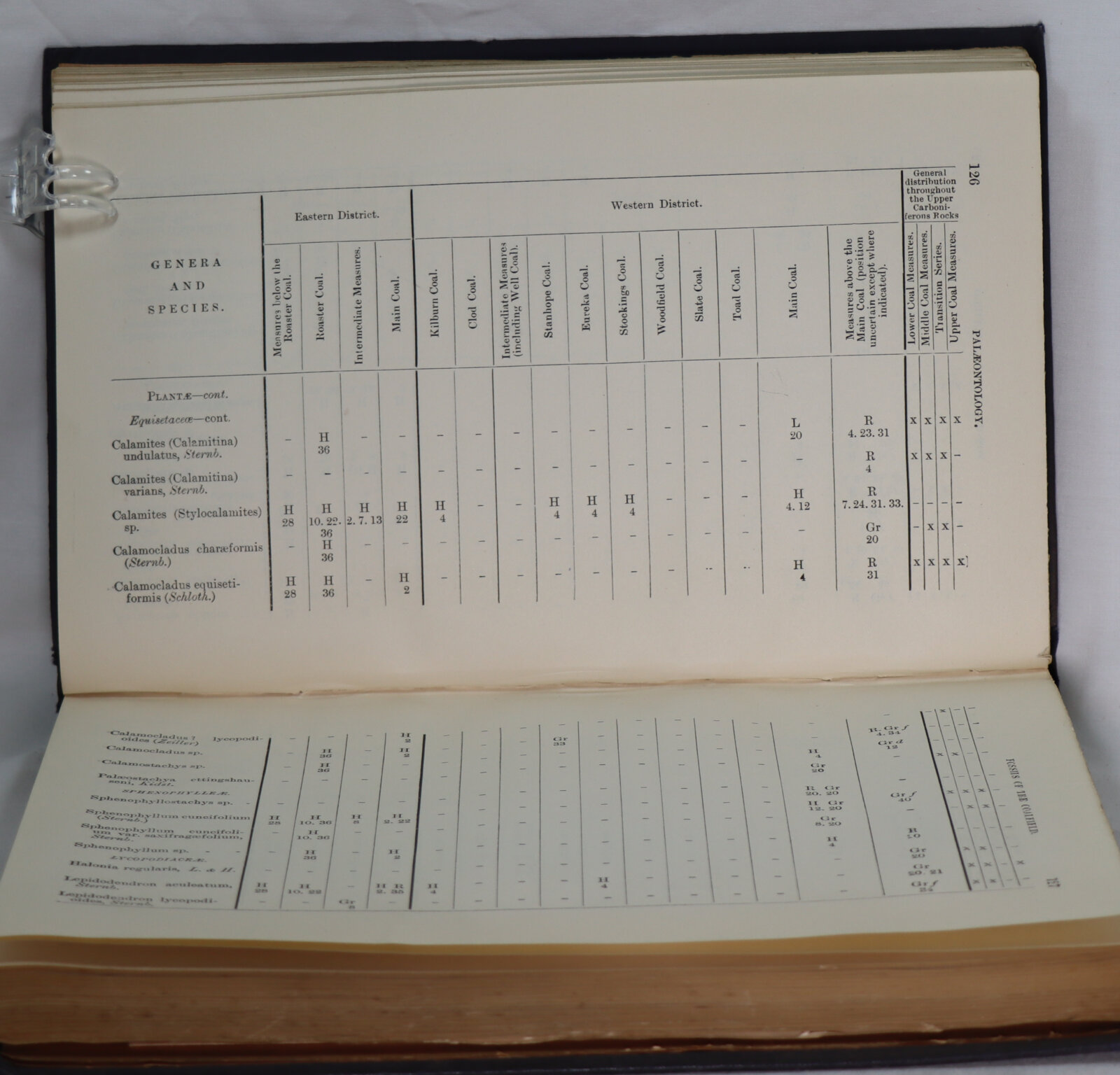
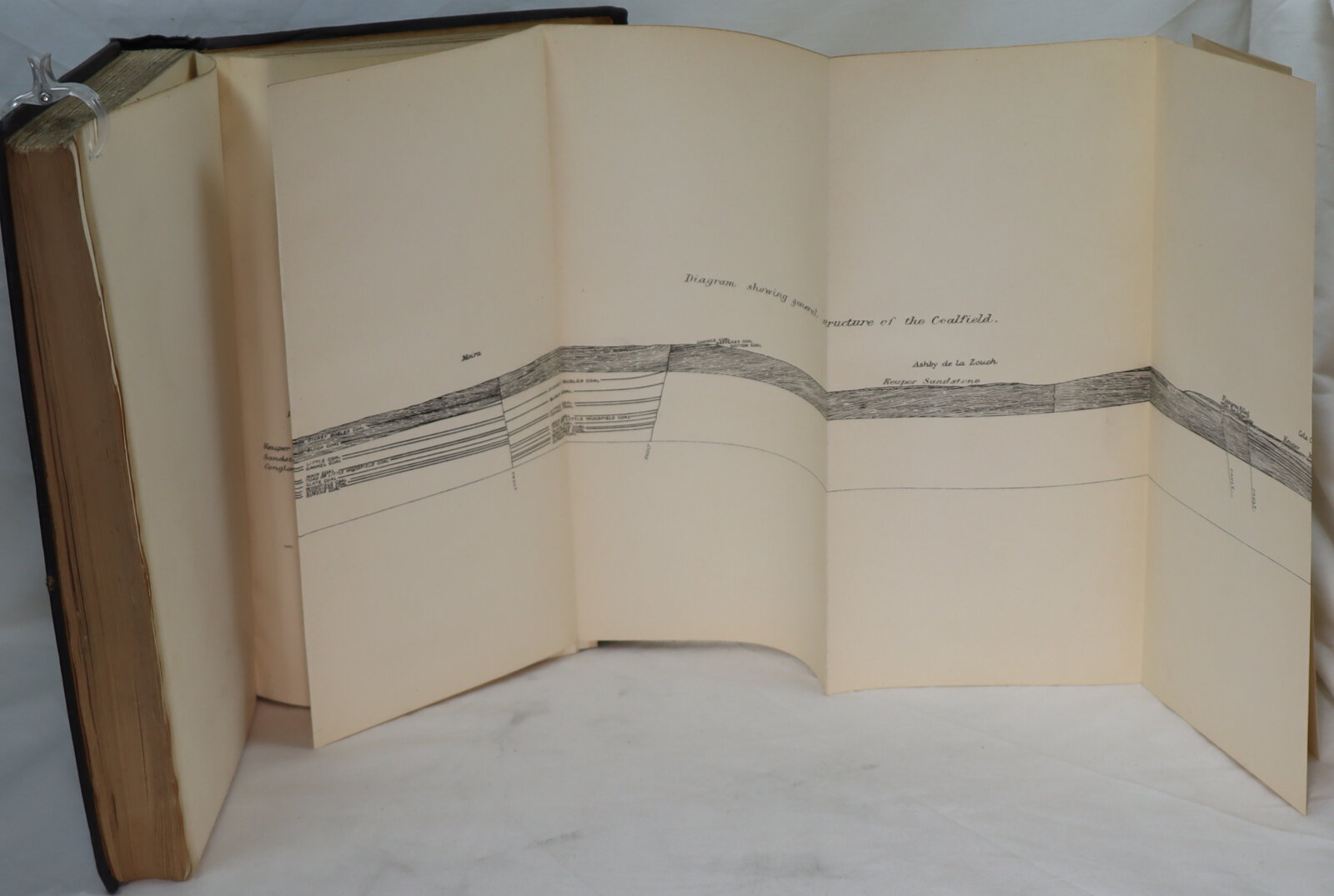
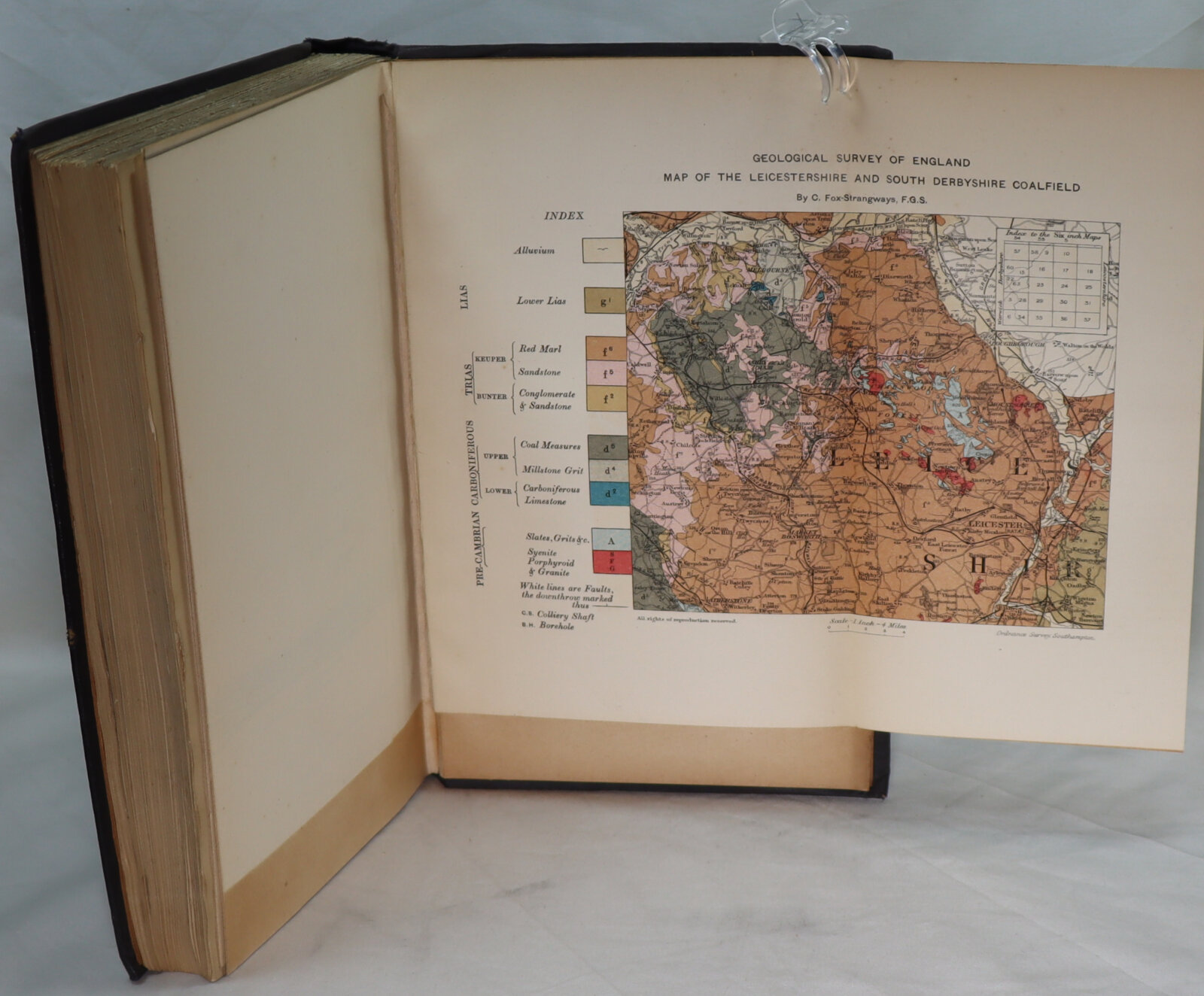
THIS latest book contains a description of the joint coalfields of Leicestershire and South Derbyshire, commonly known as the Leicestershire coalfield. It is one of the smallest coalfields of the Midland counties, and is cut off from the Warwickshire and Derbyshire coalfields by an uplift of older strata. It includes an area of about sixty square miles in Leicestershire, and about sixteen square miles in South Derbyshire. Its exact limit nas, however, not yet. been proved. A large portion of the area is covered by Triassic rocks, so that the Coal-measures only come to the surface over twenty-four square miles. Although one of the smallest coalfields, it is one of. the most ancient, having been worked to some -extent from time immemorial. The earliest mention of coal-being worked in the district is in the reign of King John in 1204.
Want to know more about this item?
We are happy to answer any questions you may have about this item. In addition, it is also possible to request more photographs if there is something specific you want illustrated.
Ask a question


Share this Page with a friend