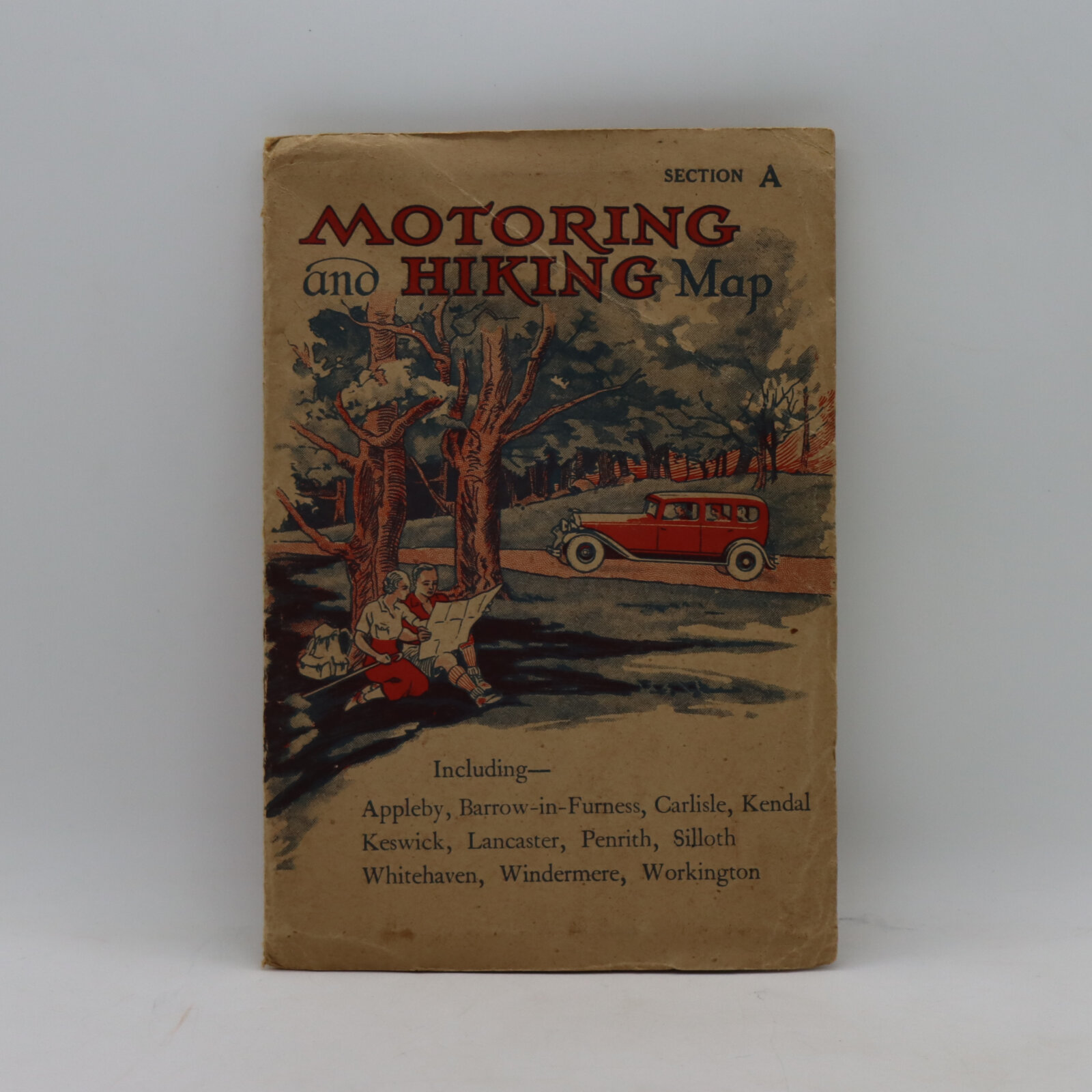
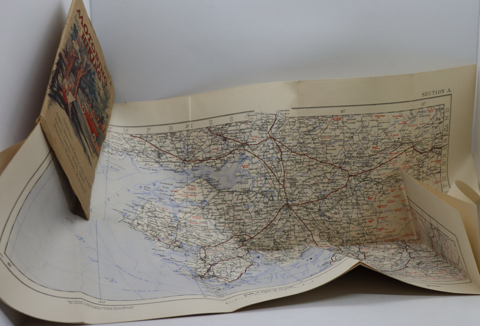
Motoring and Hiking Map. Section A.
Printed: Circa 1940
Publisher: W A K Johnston. Edinburgh
| Dimensions | 13 × 18 cm |
|---|---|
| Language |
Language: English
Size (cminches): 13 x 18
Condition: Fine (See explanation of ratings)
£16.00
Buy Now

Item information
Description
Cream card with motoring scene on the front cover, contains fold out map of Lancaster, etc.
F.B.A. provides an in-depth photographic presentation of this item to stimulate your feeling and touch. More traditional book descriptions are immediately available
Folding coloured maps on paper in illustrated motorists ‘glove compartment’ size soft card covers. Maps are clean undamaged and would date from the car model on cover to 1920-26. The publishers were prolific map and guide
printers through the mid-late 19th century and into the 20th. These on ordnance survey specs are just lovely period vintage motorist’s pre-major road maps. The areas these cover are consecutive and from the Cumbria/Tyneside areas all the way to Wolverhampton. hardly marked, light to nil with a little age to the covers in terms of brightness.
Want to know more about this item?
We are happy to answer any questions you may have about this item. In addition, it is also possible to request more photographs if there is something specific you want illustrated.
Ask a question
Share this Page with a friend