John Speed. "Map of Europe 1626"
Age: 17th Century
Condition: Excellent
Size (cminches): 56 x 62 x
£2500.00
FREE shipping
Buy Now


Item information
Description
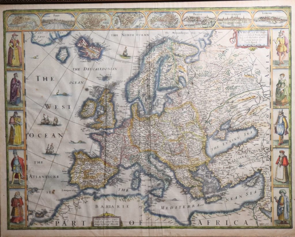
Woodcut. John Speed map of Europe. 1626. Double sided picture.
Europ, and the Cheife cities contained therein described : with the habits of most kingdoms now in use. By Jo: Speed. Ano : Dom: 1626
Original engraved map with hand colour published in Speed’s ‘Prospect of the Most Famous Parts of the World’ sold in popeshead alley, against the Exchange by George Humble 1626. 500mm x 615mm.
With eight inset views at the top showing the cities of London, Paris, Rome Constantinople, Venice, Prague, Amsterdam & Lisbone.
Ten costume vignettes down the side showing the fashions of Europe’s inhabitants.
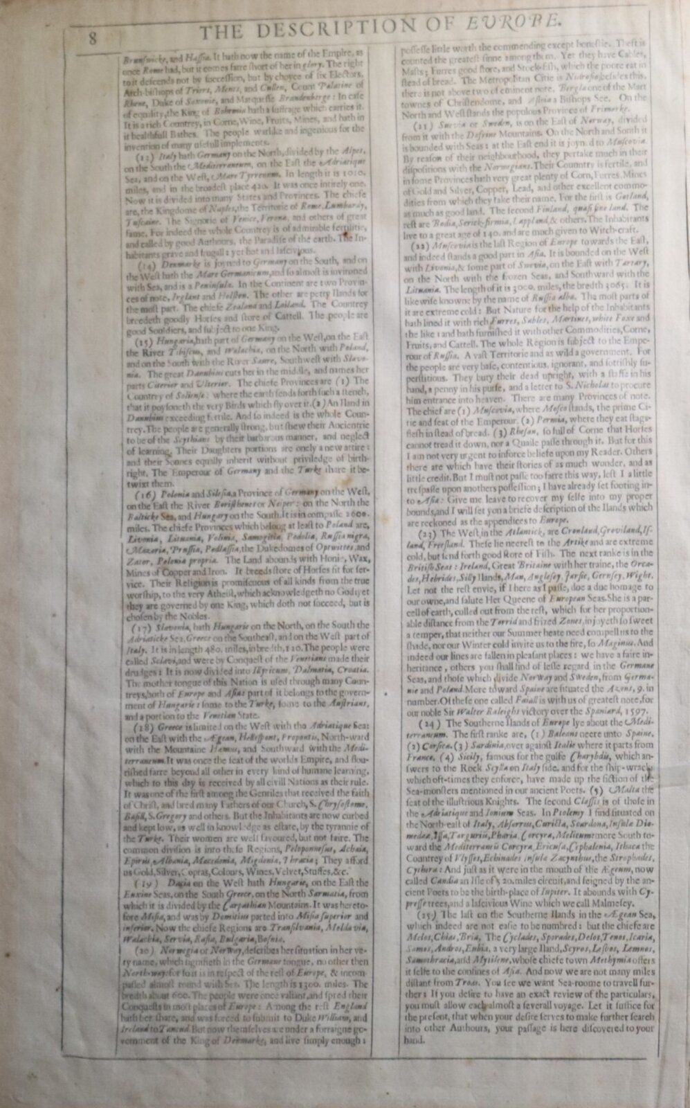
With English text on the reverse.
Want to know more about this item?
We are happy to answer any questions you may have about this item. In addition, it is also possible to request more photographs if there is something specific you want illustrated.
Ask a question


Share this Page with a friend