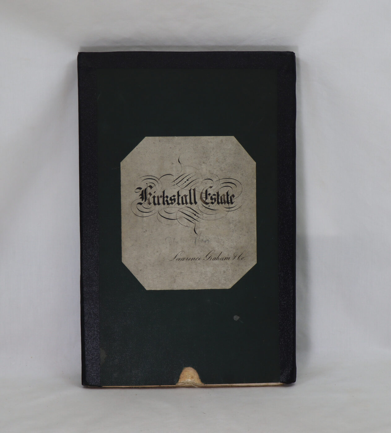
Graham of Kirkstall Estate Map.
Printed: Approx 1860
Publisher: Kirkstall Estate.
| Dimensions | 21 × 31 × 2 cm |
|---|---|
| Language |
Language: English
Size (cminches): 21 x 31 x 2
Condition: Very good (See explanation of ratings)
£950.00
FREE shipping
Buy Now


Item information
Description
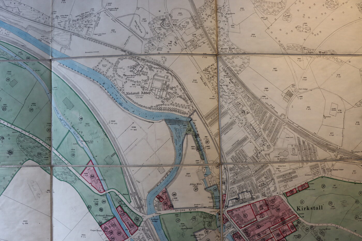
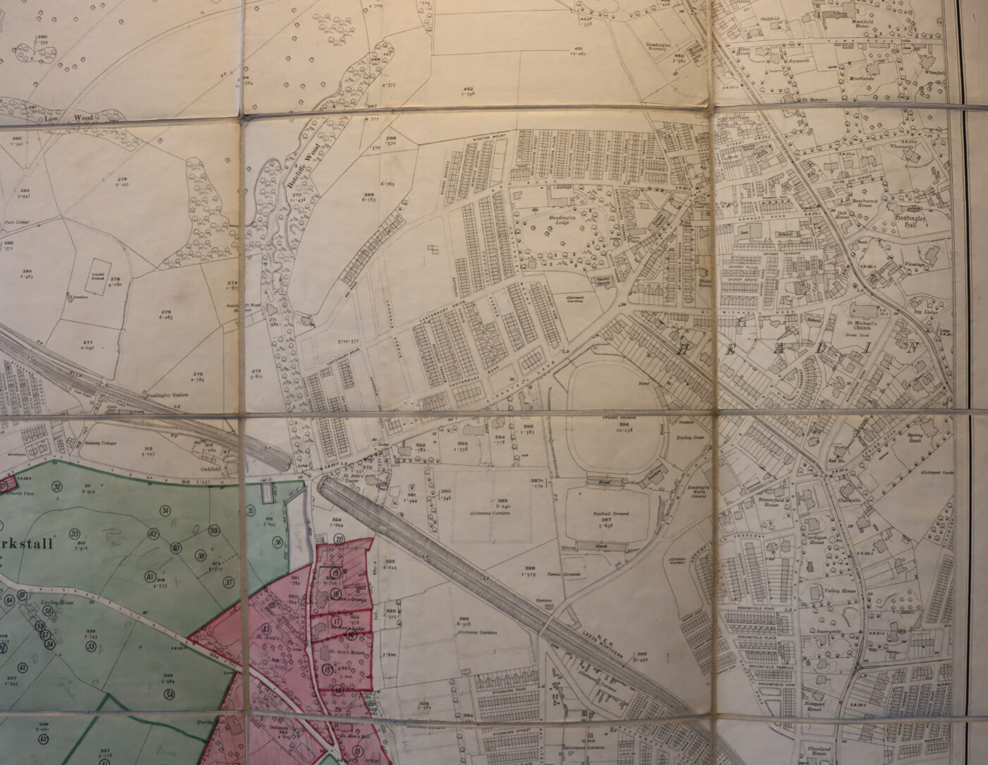
In the original sleeve box. Cloth backed map of the estate of Kirkstall, on the outskirts of Leeds.
Scale 1:2500. (opened out approx. size 56 inches x 58 inches) Dimensions refer to folded up the sleeve box.
We provide an in-depth photographic presentation of this item to stimulate your feeling and touch. More traditional book descriptions are immediately available
- Note: These booklets and family estate map carries a £5.00 discount to those that subscribe to the F.B.A. mailing list
Printed in approximately 1860 and last updated for the family in about 1895
The map size is 56 inches x 58 inches – scale 1:2500. Box size (inches): 8.4 x 12.4 x 0.8 refers to the folded up sleeve box.
Accompanying this unique map is Canon W.H. Mackean’s booklet ‘THE GRAHAMS OF KIRKSTALL’ with further accompanying map explanations to Britain’s oldest continuous industrial site.
Please view our photographs of this unique map. An excellent talking point to grace the wall of any quality home. Details of Mackean’s booklet will be provided upon application.
Want to know more about this item?
We are happy to answer any questions you may have about this item. In addition, it is also possible to request more photographs if there is something specific you want illustrated.
Ask a question

Share this Page with a friend